Photo: AirNow
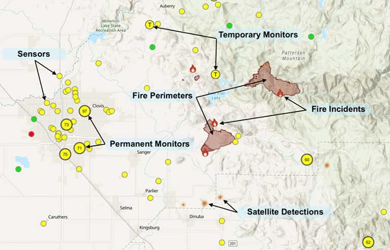
Washington — In an effort to help protect workers from wildfire smoke, the Environmental Protection Agency and U.S. Forest Service have updated their AirNow Fire and Smoke Map mobile app.
Additions include air quality monitoring information on coarse particle pollution and ozone, as well as info on individual fire activity, when available.
“The map pulls data from monitors that regularly report to AirNow, temporary monitors such as those the Forest Service and air agencies have deployed near fires, and crowd-sourced data from nearly 15,000 low-cost sensors that measure fine particle pollution – the major harmful pollutant in smoke,” EPA says.
NIOSH has cited studies showing that exposure to particulate matter from wildfires can result in heart and lung problems – and possibly death.
“As millions of Americans have experienced, wildfire smoke can travel for hundreds of miles, including from Canada, affecting people anywhere in the United States,” Joseph Goffman, EPA assistant administrator for air and radiation, said in a press release. “The updated AirNow Fire and Smoke Map makes even more information available about wildfire smoke and air quality – information anyone across the country can use to reduce their exposure and protect their health.”
The app is available for Apple and Android devices.
McCraren Compliance offers many opportunities in safety training to help circumvent accidents. Please take a moment to visit our calendar of classes to see what we can do to help your safety measures from training to consulting.
Original article published by Safety+Health an NSC publication


